

Africa is highly vulnerable to the impacts of climate change. As climate impacts grow, they put pressure on food systems and cause more people to migrate to the cities. Climate services can help people deal with these impacts and prepare for them. However, these services are still limited. They are often organised in a top-down way and mainly focus on the national level.

What is the project about?
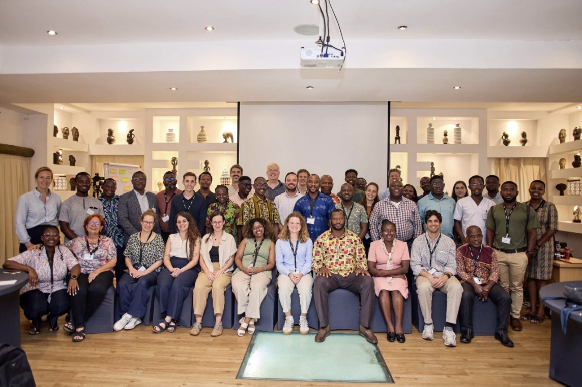
SAFE4ALL Africa is a European-African research and innovation project that aims to strengthen climate resilience and food security in Kenya, Ghana and Zimbabwe. Together with seventeen partners, we develop climate services that meet the needs of users in these countries. These services help people make better decisions in a changing climate. For example, a farmer can decide when to sow crops next week, while a city can plan for the climate conditions expected in 2050.
What is our role?
Within SAFE4ALL, we focus on local embedding and learning. Our goal is to make sure that SAFE4ALL’s products and tools become part of the daily work of end-users and fit within existing organisational structures. Also, we co-create the Climate Impact Atlases for Kenya, Ghana, and Zimbabwe. These atlases will be the first public one-stop shops for long-term climate impact information in these countries.
Local embedding and learning
For the tools to make a difference, people need to use them in their daily work. That is why we work closely with the intended end-users of the SAFE4ALL tools. Farmers, extension officers and local governments are all part of the development process. We exchange knowledge, create suitable materials, and co-design the tools.
An important part of this work is the SAFE4ALL Learning Program. In 2025, more than 900 people joined our online sessions. Alongside this program, we are building an in-person community. Members of this community help develop the tools and get together for more in-depth training. During these sessions, they map local climate impacts, define what resilience means in their own situation, and create climate stories.

Music video and story map
We also develop climate stories and visualisations that match the needs of the intended users. For example, we worked together with local partners to create a music video about the importance of weather forecasting and a story map about the impacts of climate change on rice production in Northern Ghana, introduced in the video below.
What is the project about?
SAFE4ALL Africa is a European-African research and innovation project that aims to strengthen climate resilience and food security in Kenya, Ghana and Zimbabwe. Together with seventeen partners, we develop climate services that meet the needs of users in these countries. These services help people make better decisions in a changing climate. For example, a farmer can decide when to sow crops next week, while a city can plan for the climate conditions expected in 2050.
What is our role?
Within SAFE4ALL, we focus on local embedding and learning. Our goal is to make sure that SAFE4ALL’s products and tools become part of the daily work of end-users and fit within existing organisational structures. Also, we co-create the Climate Impact Atlases for Kenya, Ghana, and Zimbabwe. These atlases will be the first public one-stop shops for long-term climate impact information in these countries.
Local embedding and learning
For the tools to make a difference, people need to use them in their daily work. That is why we work closely with the intended end-users of the SAFE4ALL tools. Farmers, extension officers and local governments are all part of the development process. We exchange knowledge, create suitable materials, and co-design the tools.
An important part of this work is the SAFE4ALL Learning Program. In 2025, more than 900 people joined our online sessions. Alongside this program, we are building an in-person community. Members of this community help develop the tools and get together for more in-depth training. During these sessions, they map local climate impacts, define what resilience means in their own situation, and create climate stories.
Music video and story map
We also develop climate stories and visualisations that match the needs of the intended users. For example, we worked together with local partners to create a music video about the importance of weather forecasting and a story map about the impacts of climate change on rice production in Northern Ghana, introduced in the video below.
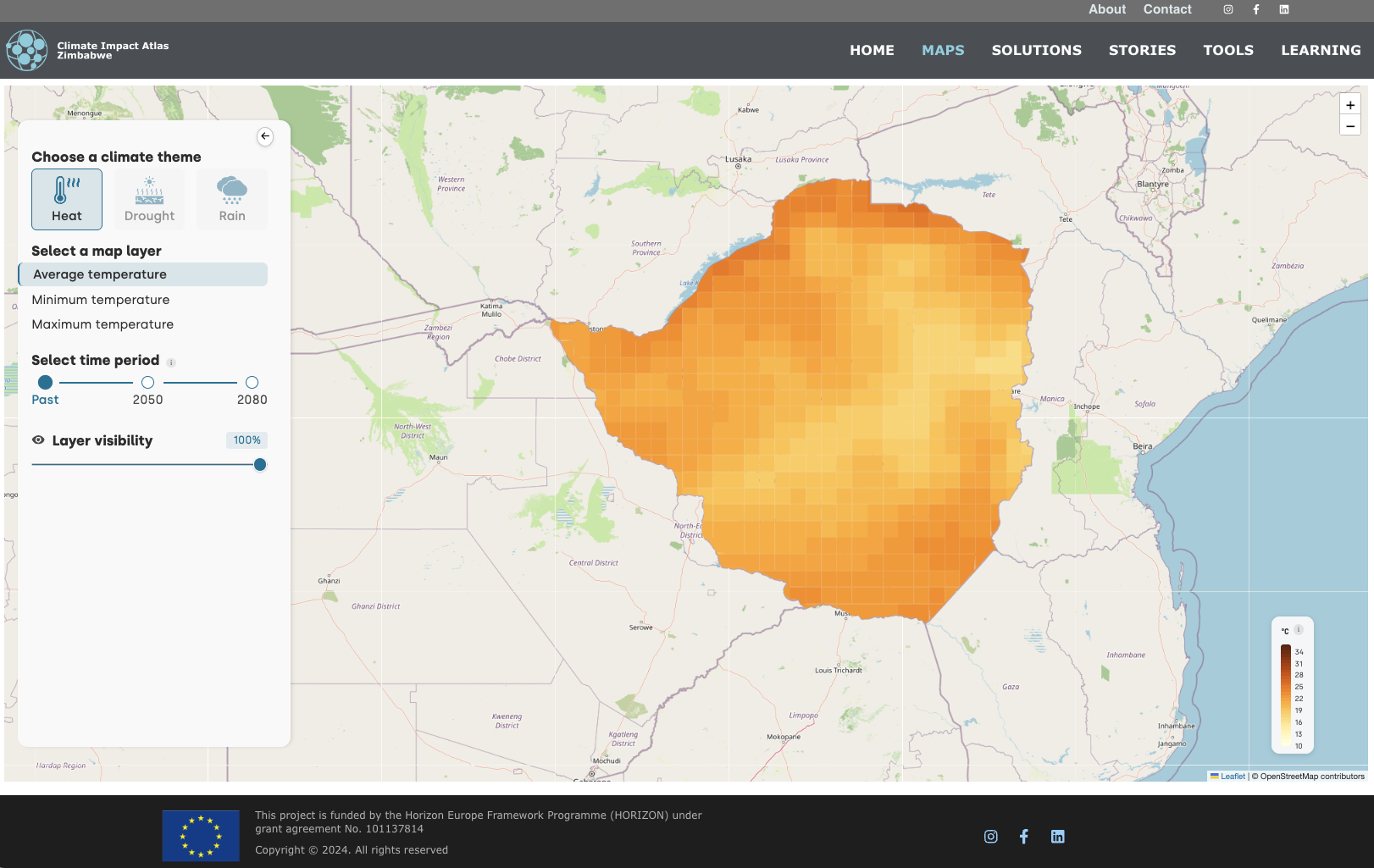
Three Climate Impact Atlases
Kenya, Ghana and Zimbabwe will all feel major impacts of climate change. Governments and organisations are already developing policies and taking action. However, there is still no public one-stop shop that brings together all climate impact information. As a result, decision-makers often lack the data they need.
To address this gap, we are co-developing a Climate Impact Atlas for each of the three countries. We build on our experience in other countries while adapting the atlases to local needs and conditions. We develop them together with national meteorological services, universities, and farmers’ unions.
The atlases show how rainfall, drought, heat, and flooding may change by 2050 and 2100. They combine maps with custom-made tools, such as the Critical Threshold Explorer. In addition to data, the atlases include climate stories, adaptation options, and learning materials. All atlases are built with open-source software and our goal is to transfer them to a national partner before the project ends.
Visit the Climate Impact Atlases: